Compare / context framing
Lower visible-change context
Visible-change mode only
Earlier reviewed image
How the earlier image is being used
- The earlier reviewed image is shown only as rough context for visible change, not as a precise baseline for outcome claims.
Later reviewed image
What the later image is allowed to show
- The later reviewed image is presented only as visible change around the berth area, not as proof of a specific facility outcome.
Claim boundary
What this page does not overclaim
- The reviewed pair supports a cautious visible-change read around the berth and adjacent water. It does not support a stronger claim about the condition of any specific terminal structure or facility component.
- The lower pair is kept in visible-change mode only. It adds context around the berth area, not a precise outcome readout.
Earlier reviewed image
Planet before asset
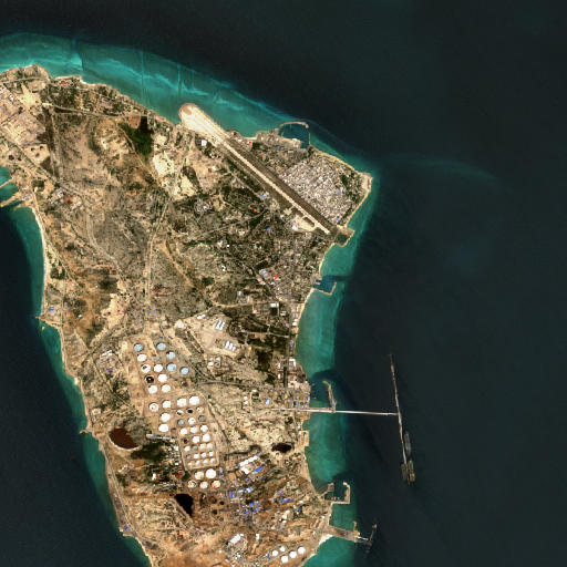
This lower frame keeps the earlier image as loose visual context only. It does not introduce feature-level labels or a precise baseline for outcome claims.
Visible change only
Planet after asset
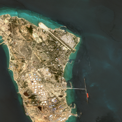
This lower frame keeps the later image at broad visible change only. It does not attach precise feature-level labels or a stronger facility-outcome claim.
Canonical posture
Reviewed visible-change imagery pair
MAP → incident page → imagery pair
Location posture
Geolocated
Location aligned to reviewed site coordinates.
Evidence package
4/5 surfaced attachments
1 claims · 1 baselines
Surface framing
The lower pair is surfaced only as broad visible-change context beneath the single-image hero. It should be read as reviewed earlier-versus-later imagery, not as a precise outcome readout.
Surfaced evidence objects
Earlier image posture
Rough visual context only
No callout layer
This lower frame keeps the earlier image as loose visual context only. It does not introduce feature-level labels or a precise baseline for outcome claims.
Precise baseline callouts are intentionally withheld on this incident.
Later image posture
Broad visible change only
No callout layer
This lower frame keeps the later image at broad visible change only. It does not attach precise feature-level labels or a stronger facility-outcome claim.
Precise later-image callouts are intentionally withheld on this incident.