Compare / context framing
Visible aftermath packaging
Aftermath-only packaging
Surface posture
Why this stays aftermath-only
- No separate baseline is surfaced on this public page.
Visible evidence
What the public frame is actually carrying
- Reviewed visible break in the bridge structure within the public-safe image.
- Highlights the broken approach connection visible in the same reviewed frame.
Claim boundary
What this page does not overclaim
- The staged ground image visibly shows the bridge destroyed and is strong enough for an honest visible-destruction card. Keep the claim scoped to the photo and provenance presented.
- No defendable before frame is implied.
Aftermath only
Wikimedia Commons destruction photo
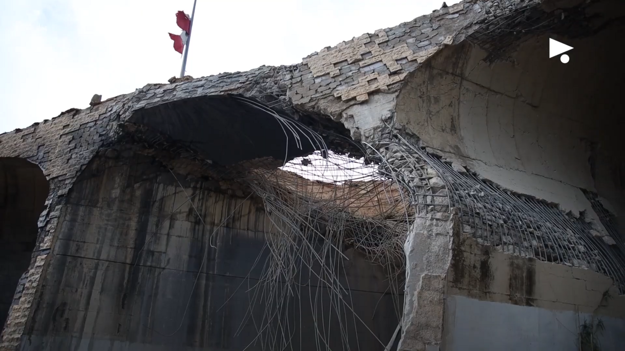
Collapsed bridge span
Severed approach
River crossing
Real aftermath image showing the Qasmiyah Bridge visibly destroyed.
Honesty lock
WarDataLab AI is intentionally showing reviewed aftermath evidence only here. No defendable before frame is being claimed on this public surface.
Why
The staged ground image visibly shows the bridge destroyed and is strong enough for an honest visible-destruction card. Keep the claim scoped to the photo and provenance presented.
Canonical posture
Image-backed aftermath evidence
MAP → incident page → aftermath evidence
Location posture
Geolocated
Location aligned to reviewed site coordinates.
Evidence package
2/2 surfaced attachments
2 claims · 0 baselines
Surface framing
The page is packaged around the strongest reviewed aftermath visual only. No hidden baseline is implied.
Surfaced evidence objects
Baseline posture
No public baseline surfaced
Held back
WarDataLab AI is intentionally keeping the public board on the aftermath frame because a defendable baseline pair is not cleared.
No baseline frame is publicly surfaced on this incident.
After-state callouts
Wikimedia Commons destruction photo
3 saved callouts
Real aftermath image showing the Qasmiyah Bridge visibly destroyed.
circle
Collapsed bridge span
Reviewed visible break in the bridge structure within the public-safe image.
arrow
Severed approach
Highlights the broken approach connection visible in the same reviewed frame.
marker
River crossing
Context marker to orient the infrastructure damage reading.